Нефть и газ
Полное исследование, 128.5 км2. Выбор точек под бурение скважин. Оценка прогнозных ресурсов. США, Техас, 2011.
28.125997
-98.576477
Нефть и газ
Полное исследование, 3050 км2. Выбор точек под бурение скважин. Оценка прогнозных ресурсов. Индонезия, о. Ява, 2012.
-7.510278
113.583333
Алмазы
Полное исследование, 130 км2. Оценка прогнозных ресурсов. Центральная Африка, Конго, 2011.
1.716667
25.433333
Нефть и газ
Дистанционное исследование, 1101 км2. Поиск и оконтуривание УВ-аномалий. Австралия, Квинсленд, 2013.
-28.447778
149.451944
Уран
Полное исследование, 29820 км2. Выбор точек под бурение скважин. Оценка прогнозных ресурсов.. Монголия, аймак Увс, 2013.
49.733333
91.866667
Нефть и газ
Полное исследование, 9 км2. Опытно-промышленные работы. Россия, Иркутск, 2019.
57.916667
105.75
Нефть и газ
Полное исследование, 20 км2. Опытно-промышленные работы. Россия, Якутия, 2020.
61.574722
113.501111

Innovative mineral prospecting

Exploring the area from space

In the beginning, we study the area using aerial photography. We send the images to the laboratory, where they are processed and kept in the reactor. The light zone from the photograph is resettled to the area map. Even at this stage, the reliability of the results is 65-70%.

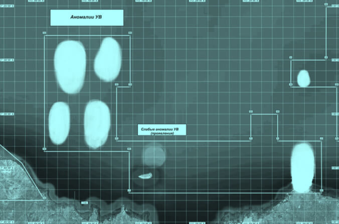
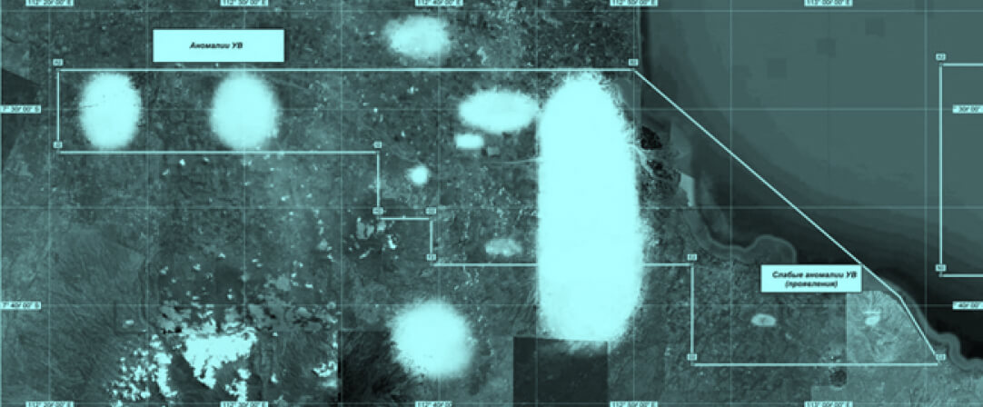
These are the pictures. White spots are the boundaries of the identified anomalies, a promising area for further detailed research.

RESULT

We determine the coordinates of the area where exactly the minerals are.

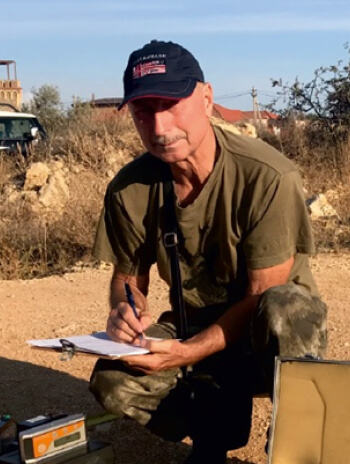
Setting out to the area with field equipment

The team with field equipment sets out to the received coordinates. No need to involve heavy equipment and cut down forests. Th team registers a resonant electromagnetic field specific to each type of mineral.

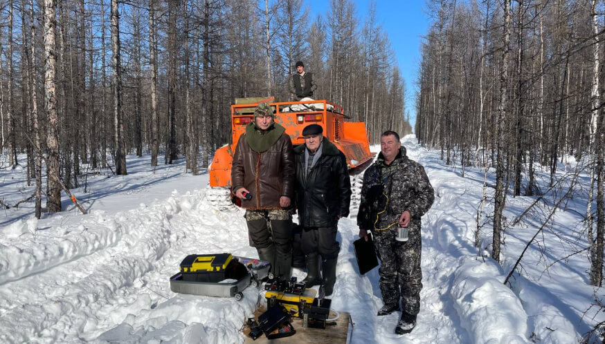
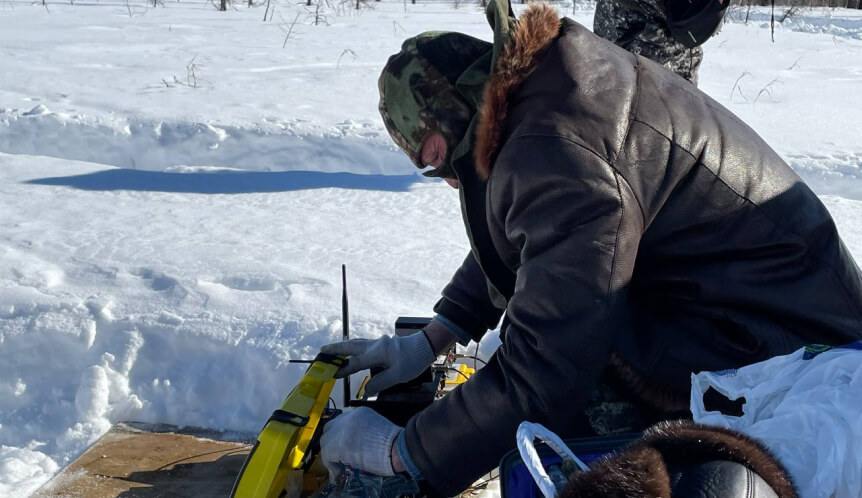
3-4 people will cope with the placement of the equipment, the work is carried out without drilling in any area and in any season.

RESULT

We determine the parametric data of minerals and send it to the laboratory for detailed study

Analyzing data and compiling a report

Our experts analyze the results and make a report. The data will be enough to get a productive well the first time with an accuracy of 98%.
RESULT

You get all the data to build a detailed field model

As a result, we get

You drill a productive well on the first try and save the resources
INFORMATION WE PROVIDE :
— the depth of the substance,
— temperature,
— pressure,
— porosity and permeability,
— oil-water contact and gas-oil contact.

To get started, we request

  1. Site coordinates.
  2. The type of mineral sought for.
  3. To improve accuracy - samples or composition of the desired mineral, mined within a radius of up to 100-200 km from the search site.

We can detect any chemical element, but there are a few limitations:

We do not undertake the search for six elements of the platinum group: ruthenium, rhodium, palladium, osmium, iridium, and platinum.

Drilling, water injection, or other fracturing activities have already taken place.

Ru, Rh, Pd, Os, Ir, Pt

Reasons why you can trust us

Since 2003, more than 70 practical geological prospecting works have been carried out in various countries:
Ukraine
Mongolia
Kazakhstan
Cyprus
USA
Australia
UAE
Turkey
Russia
DR Congo
Mauritania
Colombia
They confirmed the high efficiency of detection and study of the characteristics of the occurrence of minerals:
oil
coal
molybdenum
fresh geothermal waters
gas
copper
tungsten
uranus
gold
diamonds

Befefits of working with us

— Reducing the cost of raw materials produced
— We also reduce the risks of drilling inefficient wells
— We find quickly
— Working in an environmentally friendly way
— Exclusion of dry wells
— We spend the budget rationally

As a result, we save time and money for the customer.

Who are we

A word about our team

Today –  innovation.
Tomorrow – way of life.